TL;DR
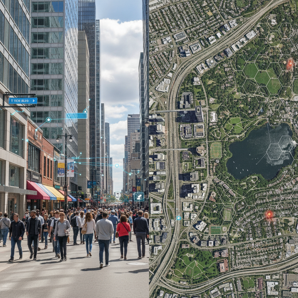
- Street View (GSV) offers high-resolution, ground-level visual context, ideal for applications requiring detailed local information, visual verification, and human-centric perspectives like real estate, local search, and field service routing.
- Satellite Imagery (SEA) provides broad-area coverage, historical trends, and macro-level insights, best suited for large-scale monitoring, urban planning, agriculture, and infrastructure analysis where detail isn't as critical as scope.
- Choosing between them depends on your specific use case: GSV for 'what's on the ground right now' and human-scale detail; SEA for 'what's happening over a large area' and historical patterns.
- Integration involves APIs like Google Maps Platform or Mapbox, requiring careful consideration of costs, data freshness, and processing power. A hybrid approach often yields the best results.
- Focus on business outcomes: Your choice should directly support your product's core value proposition, managing development speed and long-term operational costs.
Introduction
In today's competitive landscape, many successful startups leverage location intelligence to deliver unique value. Whether you're building a logistics platform, a real estate analytics tool, a field service management system, or a hyper-local marketplace, understanding the physical world is paramount. But not all geospatial data is created equal. The choice between ground-level imagery (like Google Street View) and overhead satellite imagery isn't just a technical one; it's a strategic decision that impacts your product's capabilities, development costs, and speed to market.
As a founder or product manager, you need to cut through the jargon and understand the practical implications of each. This article will demystify Street View (GSV) and Satellite Imagery (SEA), offering a pragmatic guide to help you choose the right data source for your specific business needs, considering cost, speed, and risk.
Understanding the Players: Street View (GSV) and Satellite Imagery (SEA)
Before diving into use cases, let's briefly define what we're talking about. Both GSV and SEA provide visual representations of the Earth, but from fundamentally different perspectives and with distinct characteristics.
Google Street View (GSV): The Ground-Level Perspective
GSV, spearheaded by Google, offers panoramic, street-level images taken from vehicles, trikes, and even backpack-mounted cameras. It provides a human-eye view of streets, buildings, and local environments. Think of it as virtually walking down a street, observing storefronts, road conditions, and neighborhood details.
Strengths of Street View
GSV's primary strength lies in its detail and context. It captures the immediate surroundings, offering a granular view that satellite imagery simply cannot match. This includes building facades, signage, road markings, pedestrian infrastructure, and the general ambiance of a location. For applications where visual verification or human-scale interaction is key, GSV is invaluable.
Its accessibility through robust APIs makes integration relatively straightforward for developers. The data is often updated regularly in urban areas, ensuring a reasonable degree of freshness for many use cases. The ability to 'see' what a customer or field agent would see on the ground is a powerful differentiator.
Use Cases for Street View
- Real Estate & Property Tech: Virtual property tours, assessing neighborhood amenities, verifying property conditions, identifying potential issues like overgrown landscaping or property damage before a physical visit.
- Local Business Intelligence: Analyzing storefront visibility, competitor presence, pedestrian traffic indicators, and accessibility features for local businesses.
- Field Service & Logistics: Pre-visualizing delivery points, identifying specific building entrances, assessing parking availability, and planning optimal routes for service technicians or delivery drivers.
- Insurance Claims & Damage Assessment: Documenting pre-existing conditions or assessing post-event damage from a ground-level perspective without immediate physical deployment.
- Urban Planning & Infrastructure: Identifying street furniture, analyzing sidewalk conditions, assessing public space quality, and planning for accessibility improvements.
Limitations of Street View
While powerful, GSV has its limitations. Coverage is primarily restricted to publicly accessible roads and pathways, meaning rural areas or private properties often lack data. Data freshness varies significantly; while major cities are updated frequently, less populated areas might have images several years old. Privacy concerns also mean faces and license plates are blurred, which can sometimes obscure crucial details. The cost of extensive API usage can also become a significant factor for high-volume applications.
Satellite Imagery (SEA): The Broad Strokes View
Satellite imagery provides an overhead perspective of the Earth's surface, captured by satellites orbiting the planet. This data ranges from low-resolution global views to high-resolution imagery capable of discerning individual vehicles or even smaller objects. It offers a macro-level understanding of land use, geographical features, and large-scale changes.
Strengths of Satellite Imagery
SEA excels in providing vast area coverage, making it ideal for applications requiring a broad geographical scope. It can capture data over remote or inaccessible regions where ground-level vehicles cannot go. Historical archives of satellite imagery are extensive, allowing for powerful time-series analysis to track changes over months, years, or even decades. This is invaluable for monitoring environmental shifts, urban expansion, or agricultural health. Furthermore, advancements in spectral imaging (beyond visible light) allow for insights into vegetation health, water quality, and material composition, which are impossible with standard ground-level photos.
Use Cases for Satellite Imagery
- Agriculture & Forestry: Monitoring crop health, predicting yields, detecting deforestation, and managing irrigation systems across vast farmlands.
- Urban Planning & Development: Tracking urban sprawl, identifying land use changes, monitoring construction progress, and assessing infrastructure development over large areas.
- Environmental Monitoring: Detecting pollution, tracking natural disasters (floods, wildfires), monitoring glacier melt, and assessing ecological changes.
- Logistics & Supply Chain: Optimizing long-haul routes, assessing infrastructure at remote depots, and monitoring large-scale asset movements.
- Site Selection & Due Diligence: Evaluating potential development sites, assessing surrounding land use, and understanding geographical constraints for large-scale projects.
Limitations of Satellite Imagery
SEA's primary limitation is its resolution compared to GSV. While high-resolution satellite imagery exists, it's often significantly more expensive and still doesn't offer the granular, human-level detail of Street View. Cloud cover can obscure imagery, leading to gaps in data or requiring multiple captures over time. Processing satellite data, especially large datasets, can be computationally intensive and require specialized expertise, adding to development complexity and cost. Furthermore, real-time updates are less common, with refresh rates varying from daily to weekly or monthly depending on the provider and resolution.
When to Choose Which (or Both): A Decision Framework
The choice isn't always either/or. Often, the most powerful solutions combine both. Here's a framework to guide your decision:
-
What's your core problem? Are you trying to understand individual objects/details on the ground (e.g., condition of a specific building, type of signage)? Or are you analyzing large-scale patterns and changes (e.g., growth of a city, health of a forest)?
- Ground-level detail, human perspective, visual verification: Lean GSV.
- Broad area coverage, historical trends, macro analysis: Lean SEA.
-
What level of detail is actually needed? Don't over-engineer. If your users only need to know if a road exists, satellite is fine. If they need to know if there's a ramp for wheelchair access, you need Street View.
-
What's your budget and timeline? High-resolution satellite data can be very expensive, both for acquisition and processing. GSV API calls also accrue costs. Understand the pricing models of providers like Google Maps Platform, Mapbox, Planet Labs, or Maxar.
-
How fresh does the data need to be? If you're tracking real-time events or rapidly changing environments, you'll need more frequent updates. GSV updates vary, and high-frequency satellite imagery can be costly.
-
Consider a Hybrid Approach: For many sophisticated applications, combining both data types offers the best of both worlds. For example, a real estate platform might use satellite imagery to understand neighborhood development patterns (macro view) and then switch to Street View for detailed property inspection and local amenity assessment (micro view). This allows you to optimize for cost and performance, using the more expensive, detailed data only when absolutely necessary.
Practical Implementation: Integrating Geospatial Data
Integrating geospatial data into your application typically involves using APIs provided by major mapping platforms. Let's consider a practical example using Google Maps Platform, which offers both Street View and Satellite Imagery services.
Step-by-Step Integration Process (Conceptual)
- Choose Your API Provider: Google Maps Platform, Mapbox, HERE Technologies, Esri, etc. Each has its strengths, pricing, and specific API offerings.
- Obtain API Keys: Register for a developer account and generate API keys. Securely store and manage these keys.
- Identify Required Services: For Street View, you'll likely use the Street View Static API or the Street View Service for interactive panoramas. For satellite, you'll use the Maps Static API (with
maptype=satellite) or embed dynamic maps with satellite layers. - Integrate into Your Frontend/Backend:
- Frontend: For interactive maps, use JavaScript SDKs (e.g., Google Maps JavaScript API). For static images, make direct API calls from your frontend or backend.
- Backend: For server-side processing, data analysis, or generating static images, use server-side libraries or direct HTTP requests.
- Handle Data & Display: Process the API responses (e.g., image URLs, metadata) and display them within your application's UI. Ensure proper attribution as required by the provider.
- Monitor Usage & Costs: Implement monitoring for API usage to prevent unexpected billing. Set up budget alerts.
Code Snippet Example: Fetching a Static Street View Image (Python)
Let's say you want to fetch a static image of a specific location using Google Street View Static API. This is a common requirement for displaying property views or location context without a full interactive map.
import requests

# Replace with your actual API Key
API_KEY = "YOUR_GOOGLE_MAPS_API_KEY"

# Location (latitude, longitude) for the image
LOCATION = "40.712776,-74.005974" # Example: New York City Hall

# Image parameters
SIZE = "600x300" # Width x Height
HEADING = "151.78" # Direction of the camera (0-360 degrees, where 0 is North)
FOV = "90" # Field of View (0-120 degrees)
PITCH = "0" # Vertical angle of the camera (-90 to 90 degrees)

# Construct the API request URL
url = f"https://maps.googleapis.com/maps/api/streetview?size={SIZE}&location={LOCATION}&heading={HEADING}&fov={FOV}&pitch={PITCH}&key={API_KEY}"

try:
    response = requests.get(url)
    response.raise_for_status() # Raise an exception for HTTP errors (4xx or 5xx)

    # Save the image to a file
    with open("street_view_image.jpg", "wb") as f:
        f.write(response.content)
    print("Street View image saved as street_view_image.jpg")

except requests.exceptions.RequestException as e:
    print(f"Error fetching Street View image: {e}")
except Exception as e:
    print(f"An unexpected error occurred: {e}")
This snippet demonstrates a straightforward way to programmatically access GSV data. For satellite imagery, a similar approach would involve the Maps Static API with maptype=satellite and specifying a bounding box or center point and zoom level. For more advanced use cases, you'd integrate these into a larger application architecture, perhaps caching images, processing metadata, or combining them with other data sources.
Cost, Speed, and Risk Considerations
When evaluating GSV vs. SEA, always bring it back to business outcomes, cost, speed, and risk.
Cost:
- API Usage: Both types of imagery typically incur costs per API call or per data volume. Street View APIs can be quite granular (e.g., per panorama load), while satellite imagery might be priced per image tile or per square kilometer. High-resolution satellite data from specialized providers can be very expensive.
- Data Storage & Processing: If you're downloading and processing large volumes of raw satellite imagery, storage and compute costs can quickly add up. This is less common with GSV, which is usually consumed via API.
- Development & Maintenance: The complexity of integrating and maintaining these services, especially with custom processing for satellite data, translates directly into developer salaries and ongoing operational expenses.
Speed:
- Time to Market: Using readily available APIs (like Google Maps Platform) for both GSV and SEA can significantly accelerate your time to market compared to building custom imagery pipelines or licensing raw satellite data directly from providers and processing it yourself.
- Data Freshness: Consider how quickly you need data updates. If your business relies on near real-time information, you'll need to factor in the refresh rates and potential costs of high-frequency imagery.
Risk:
- Data Accuracy & Coverage: Inaccurate or incomplete data can lead to poor product decisions or frustrated users. Understand the coverage limitations and data quality of your chosen source.
- Vendor Lock-in: Relying heavily on one provider's API (e.g., Google) can create dependency. While convenient, consider the implications if pricing changes or services are deprecated.
- Privacy & Compliance: Especially with ground-level imagery, ensure your usage complies with privacy regulations and the provider's terms of service regarding data usage and display.
- Scalability: Can your chosen solution scale with your user base and data needs? Ensure the API limits and infrastructure can handle future growth without prohibitive costs or performance bottlenecks.
Key Takeaways
Choosing between Street View and satellite imagery isn't a one-size-fits-all decision. It's about aligning the data source with your product's core value proposition and understanding the practical implications for your startup's budget, development timeline, and risk profile.
- For granular, human-centric detail and visual verification: Opt for Street View.
- For broad-area analysis, historical trends, and macro-level insights: Leverage satellite imagery.
- Often, a hybrid approach that strategically combines both offers the most robust and cost-effective solution.
- Always factor in API costs, data freshness, processing requirements, and scalability from the outset.
At PolarSoftBD, we help startups navigate these complex technical decisions, building custom software that leverages powerful geospatial data to create innovative SaaS platforms, CRM systems, and MVPs. We focus on practical solutions that deliver business outcomes, ensuring your technology choices align with your strategic goals, not just academic theory. If you're looking to integrate advanced mapping or location intelligence into your product, we're here to help you build it right.